Viewing entries tagged
baja desert

"The Devil's Road" Main Expedition, Day 39

Guest blog by Bri Bruce, "The Devil's Road" Associate Producer

There is an acute and undeniable buzz in me--a palpable, electric thrumming. I'm keeping pace of it, all too aware of the nerves, an excitement I feel coursing through me right down to the tips of my fingers. And I know why. 

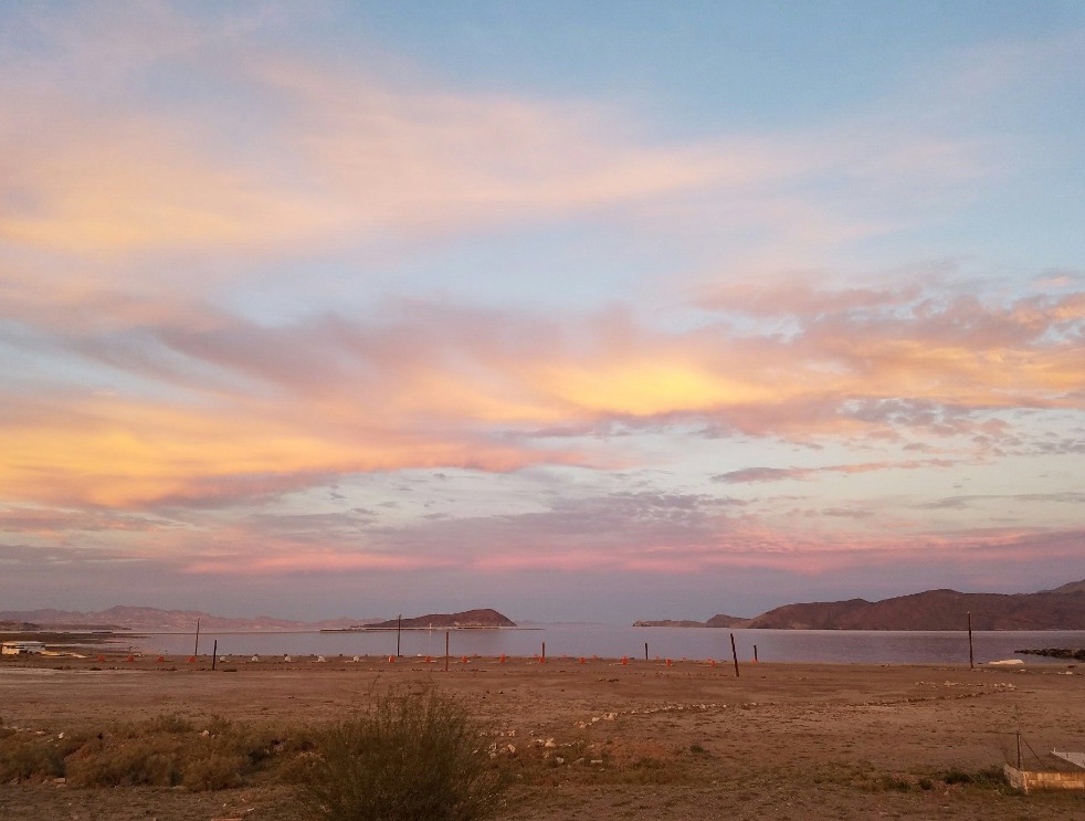
Though it's only been several years, I nearly felt my heart skip a beat at my first glimpse of the Sea of Cortez after some time. It's like seeing an old friend. This body of water is the definition of blue. Azure, cobalt, sapphire, cyan. Navy, midnight, indigo. In the cut out of the airplane window, this blue and all of its shades fills every space, halved by the plane's slice of wing. Slivers of peninsula in the distance are flanked by wisps and crescents of sandy beaches. Gusts of wind dimple the water's surface, making it look as though it is shimmering. This is the blue that one dreams about long after leaving; the blue becomes part of you.

This came to mind earlier, seated outside Gate 55 for Virgin America flight 751. I was consumed by visions of that gulf blue. In contrast, I am also reminded of the browns and tans and rusts of Baja's desert terrain. Memories become only a kaleidoscope of colors, each belonging to a part of this wild and desolate corner of the world: dusty green of cordon; impossible orange of the tulip tree; vermillion on the wings of fly catchers and cardinals; blue-black of night sky. When I think of Baja, it is in a canvas of colors and in a symphony of movement and sounds--even that of silence.

The plane dipped, and swung south over the cape. Slowly, cactus took shape, scattered as far as the base of the mountains to the north, and sectioned by straight lines of dusty roads. Before I knew it, the runway seemed to roll out beneath us, announcing our arrival. After bouncing briefly along the pavement, we came to a halt beside the terminal. 

When I stepped through the wall of heat pressing itself against the door of the airplane, immediately, as if by impulse or reflex, the word "home" came to me. Though I only stood on the tarmac of the San Jose del Cabo airport waiting for a bus beside all of the other luggage-laden passengers, I was distracted completely by thoughts of Baja--the Baja I have come to know.

For parts of my soul, this place is home. I'll never forget the desert's impossible silence, the drone of pangas in the shallow waters at dawn, machine-like clicking of cicadas at midday. As much the salt water of the gulf courses in my veins, I dream in the colors of the tala vera that adorn the entryways of tiendas and beachfront motels. On certain mornings, thousands of miles away from here, I'll notice the ocean at first light resembles the glassiness of the Sea of Cortez on a warm and windless morning. This is a Baja morning, I'll say. 

Yet, equally memory fails me, never serving again as it once did, reminded of change. With each visit, there is a vast, ever-shifting view to adjust for. I hold more fondly my oldest memories. The way things used to be. Change here is a recurring theme. Though some may call it progress or industry, it saddens me to see the quickly disappearing character and last vestiges of all that colorfully defines the Baja I've come to know intimately over my lifetime. Memories become a point of reference. The way things used to be.

Never before have I been so self-aware. I believe recent politics have lent a sharper edge to our presence here. We are Americans, gringos. Gueros. There has never been any denying our outsided-ness. Self-aware and self-conscious, I am guilty by association regardless. We often mock ourselves. Which of these are not like the others. Though we try, we are incapable of assimilating completely. We know this. 

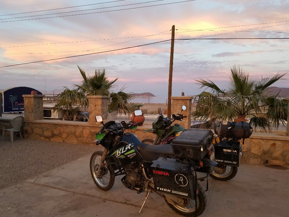
But our respect and passion for the culture and the people and the places here keep us returning. And at this, I smiled at the bus driver who offered to load my bag into the bus, told him muchas gracias, and took a seat by the window.


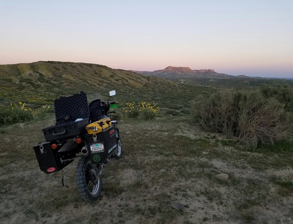
Headed north on a narrow stretch of uneven highway, we passed cinderblock fences, spikes of rebar exposed along their lengths, ranchitos with herds of goats grazing in the shade of bristly shrubs. Hot air blew in through the window. Everywhere, arms of cordon lifted skyward as if in praise. 

Twenty minutes later we turned east toward Miraflores. As we reached the central part of the town, we scanned the streets for several blocks. When we finally spotted the pair--in riding gear, bikes propped in front of a yellow building with the words La Tienda Popular overhead--their familiar faces were out of place. It was like seeing a mirage in the desert. 

For a long time, we didn't stop talking, clearly all of us excited to be reunited after a month and a half. We listened to stories of their journey, and were grateful they had come this far without significant incident. Knock on wood. 


Miraflores is a small, picturesque sloping puebla nestled against the striking backdrop of the Sierra la Laguna. Several tiendas and brightly colored houses are connected by dirt roads in the central part of the town. Bougainvillea flowers of all colors creep along fences and brick facades. A handful of abandoned buildings remain propped along the roadside. As we arrived the sun was dipping behind the crags of the mountain peaks, the dust in the air lending a hazy, almost dream-like quality to the scene. Beams of light like beacons shown out over the valley below.

Over a century ago, Nelson and Goldman rode through Miraflores on horseback during their expedition, traversing a wide arroyo--Arroyo San Bernardo--a wide riverbed, now dry (as it was then during the time of their visit) and strewn with rounded boulders shaped by past floods. The valley leads right to the base of the Sierra la Laguna, just a stone's throw from where I sit now.

Of note, the pair spoke at length about the long-leaved, wide-trunked live oaks in the area that reminded them of those that can be found in California. The road to the villa, owned by Rigoberto, the great grand nephew of Jose Cuervo (and also a good friend of revolutionary Pancho Villa) meanders through a grove of them.

Rigoberto has invited us to San Jose del Cabo, where he owns a tequila shop that features  the brand he makes. We hope to learn more about the history of the industry and of the area. 

We spent the rest of the evening at a villa, catching up, drinking mezcal, and sharing a meal of burritos with carne asada from the carniceria in town.

"The Devil's Road" Main Expedition, Day 21

To Goldman Peak

Edward William Nelson bestowed (in my mind) the ultimate honor to his respected colleague, naming a prominent peak after his friend and partner, Edward Alphonso Goldman. This peak lies just north and east of the Santa Gertrudis Mission and slightly north of the 28th parallel of latitude. Nelson described it as being near 5,000 feet of elevation. 

The crew, consisting of JT, Todd, Greg, and Guy headed up one of the old mission trails (one branch of the El Camino Real) toward Goldman Peak. This trail was built during the mission times and was, in spots, well worn and well engineered. We passed many species of cacti, saw numerous species of birds, and had some amazing views of the surrounding mountains, canyons, and geology. We passed two areas where the forefathers of today's local rancheros had built stacked rock walls to keep in or out their stock. 

On the return trip we somehow got separated. JT and I were in front, followed by Greg, then by Guy. JT and I arrived at the last significant geographical feature along the trail and decided to wait for the others. Greg arrived a few minutes later and we waited for Guy to arrive. After 20 minutes or so in the sweltering heat, Greg offered to stay behind and wait for Guy and suggested that JT and I head back to the mission, our vehicles, and more importantly, water! 

Greg stayed back for another 15 minutes and waited for Guy before he became concerned and decided to hike back up the trail and begin a series of loud yells in an attempt to get Guy's attention. Several yells later, Greg heard a reply. Too far off in the distance to understand the meaning, he continued up the trail. Rounding a corner, Greg intercepts a local caballero (cowboy), Alonzo, who was riding a mule while out checking on his cattle.

Alonzo had not seen Guy and the two began to look for any sign of our lost amigo. They tracked footprints in an arroyo that the trail crossed and started to follow the size 10 tracks until the sand gave way to gravel. A plan was devised and they decided to split up sending Greg back up to the trail and down to the mission. Alonzo was to follow the arroyo and the two would meet up at the mission. Alonzo assured Greg that all was well as he has spent his life in these mountains, could track just about anything, and had rescued many gringos from near death. 

Soon after parting, Alonzo found another footprint of Guy's and not more than a meter away was a fat, coiled rattlesnake. His worst fears began to well up inside him as he feared that our friend Guy may have also crossed paths with this desert viper. The terrain from then on was not conducive to tracking a single person wearing vibram-soled walking shoes, but Alonzo pushed onward expecting the worst of outcomes.

JT and I had been been at the mission for nearly 45 minutes when Guy strolls into the compound without a care in the world. He never saw Greg, but admitted that he heard yelling and at one point, yelled back, but could not figure out the direction or the message being yelled. The canyon walls tend to play tricks on sound when in the bottom of an arroyo

Concern gave way to a new plan. I would hike back up to the last known location for Greg and see if I could find him to give him the word that Guy was OK. Minutes later Greg walked into the compound and clearly was relieved to see that Guy was alive and unharmed. Alonzo rode in 15 minutes later and was also relieved and proceeded to tell a story about a woman that was bit by a rattler several years earlier and needed a helicopter search and rescue to get her to safety. 

We had the most lively conversation that night while sitting around the campfire. We told stories of the day, joked about what Greg would have to say to Sandy (Guy's gal) about loosing him, and about the adventure we had on the way to Goldman Peak.

Scientific director Greg Meyer in a giant cordon.

Scientific director Greg Meyer in a giant cordon.

"The Devil's Road" Main Expedition, Day 17

Yubay to Bahia de los Angeles

The decision of the day was to load JT and his camera equipment into Greg's truck and they would head up to Yubay while Todd stayed behind to keep the bikes secure and safe. They had a great trip and enjoyed the area, the tinaja, and met a couple of local cowboys. 

Meanwhile, Todd was left in the desert to bake in the 91-degree temperatures, with no wind and the only the shade cast by a few cordon cacti, a cirio, and a weak acacia tree. I drank all my water, explored the area, played hide-and-go-seek with a quail, and took several naps while waiting for the guys to return.

That evening we were welcomed at the house of Jose Mercade in Bahia de los Angeles. We swam in the bay, took a shower, and enjoyed a quiet evening. We slept on foldout cots next to the bay, a cool breeze coming off the water. Thanks, Jose, for the hospitality!

Panga in Bahia de los Angeles.

Panga in Bahia de los Angeles.

"The Devil's Road" Main Expedition, Day 16

Bahia de los Angels to Yubay

JT and I had a lazy morning while we finished packing our bikes. We needed to meet Greg and Guy at Yubay that night, so we set off out of town with full tanks of gas, plenty of water, and a little extra food. Before leaving town, we stopped and had lunch at Alejandrina's Restaurant and had a great meal. 

We turned off the main road onto the road to Yubay (we thought) and headed out into the desert. Soon after leaving the tarmac we got bogged down with sand. Then we were in the rocks and the going was better. After about 5 miles we began watching the GPS arrow indicator wanting to send us in a different direction. We came upon an abandoned mine and the road disappeared. We consulted the map and figured we turned off the main road too soon, so we turned around.

Once we were on the right road to Yubay, we quickly found ourselves in deep sand again. Figuring we were ahead of Greg and Guy, we decided to camp out until they arrived and spend the night right there. Greg and Guy agreed with our assessment of the road conditions and we moved camp up next to the rocks. We had a great fire, several beers and cracked open a bottle of red wine as the sun was setting. What a perfect night to relax and figure out our next move.

"The Devil's Road" Main Expedition, Day 15

Middle of nowhere to Bahia de los Angeles

During our debriefing last night we realized that we were one day ahead of schedule. Not wanting to camp at Yubay for two nights, we decided to head to Bahia de los Angeles, get a hotel, shower (since we have not had one in five days), charge all of our gear and batteries, and regroup.

Tomorrow we will head out to Yubay and meet Greg and Guy to film the tinaja and surrounding areas. 

Sunset over Bahia de los Angeles.

Sunset over Bahia de los Angeles.

"The Devil's Road" Main Expedition, Day 14

Cataviña to the middle of the desert

All ten of us set off to see some of the sights on Nathan's ranch. The ranch, La Bocana, is located where three rivers converge. We saw two ancient "rock circles" built by the native Baja California peoples thousands of years ago, and found basalt rocks that were chipped to use as cutting tools. We found puma scat, swam in the pool of water in an oasis, and photographed several rock art sites. What an experience and well worth the difficult road to get in and out. 

Cave paintings at La Bocana

Cave paintings at La Bocana

We then set our sights on Calamajue. This is a small bay that was used as a ship landing to offload supplies for the miners in the area and to load shipments heading back to Guaymas or Ensenada. Coco's Corner is well known to those in the motorcycle and adventure crowd and was a confirmed stop of ours. A short consultation with Coco made it clear that the road to Calamajue would not be doable on these bikes unless we were "loco." So, another finely planned adventure was aborted and we were forced back out to the highway and continued heading south.

A short drive on a side road to find a good camp spot turned out shorter that we expected as we hit deep sand and I dumped my bike again. We decided to camp right there for the night. The wild flowers were in full bloom and we slept among a flowerbed of blue and purple flowers. 

Coco points to "The Devil's Roa" sticker we gave him during our preliminary expedition to Baja. Thank you, Coco!

Coco points to "The Devil's Roa" sticker we gave him during our preliminary expedition to Baja. Thank you, Coco!

"The Devil's Road" Main Expedition, Day 13

El Rosario to Cataviña

We were off quickly with a full day's filming schedule ahead of us. Our first stop was to take the 22-kilometer road out to El Marmol. This is an old abandoned onyx mine. It was being worked when Nelson and Goldman came through, but did not see it's hey day until the early to mid 1900s. The rock was said to be the finest in North America and was shipped to many parts all over the world. It is also the site of the only schoolhouse built of onyx. Now in ruins, it is clear to see the onyx walls and construction still standing tall. 

We attempted to take a side trip to Agua Dulce along the old El Camino Real. Now it is a private ranch, but in 1905 it was the only fresh water around for many miles. The "road" quickly turned into a sand pit and we made the decision to abort that attempt.

On the return to the main road, I dumped my bike at a slow speed on a small hill and it took both of us to right the heavy bike.  

While in the Sierra San Pedro Martir, we met Nathan, a young biologist and guide. He offered for us to stay at his cabin when we came to town. Arriving at his family's restaurant was a whirl of frenzied activity, as there were seven other people also invited to stay at his cabin. All of these folks were photography enthusiasts and two were Nathan’s friends we had met in the mountains.  

In a flurry, we left to his cabin "just twenty minutes away." Not knowing where we were going and just following the truck in front of us was not a good feeling for me. But, I trusted Nathan and the group was enthusiastic. It turned out to be twenty miles on the worst road I have ever been on. The sand was the worst. As the sun was setting, it was getting harder and harder to see the tracks in front of us. We finally made it, and I only dumped the bike 5 times compared to JT's one.  

Nathan's cabin sits on an 8,000-acre ranch and we were promised a tour that would be like no other in the morning. We all sat around a big fire, made burritos, and drank beer, tequila, and mescal. We crashed in the bunk beds in one of the many rooms of the cabin. 

Nathan, local Catavina resident.

Nathan, local Catavina resident.

"The Devil's Road" Main Expedition, Day 12

San Quintin to El Rosario

Without a room for the night, we were forced to sleep in the parking lot. The three hotels in the area were full for the night and as it was near dark when we arrived, we were not going to head back into town to find lodging. We woke with all of our gear soaked in dew and commotion about the area. Our only salvation was to quickly pack up and head south (without coffee or breakfast).

We arrived at Mama Espinoza's Restaurant an hour later and were immediately greeted by Elvira Espinoza (Doña Anita's daughter) who now runs the restaurant. She was very gracious and invited us to stay and enjoy the festivities with "This is your house, too!" We were told there was a benefit motorcycle ride the day before and today was an opportunity to give the town’s children beans, rice, and a toy. Many of the children and their parents showed up to receive a gift.

We were able to interview Elvira with interpretation help from her grand daughter, Michele. This is a wonderful and big family that does so much for the community. We met many family members that travelled from as far away as Ensenada and Tijuana to participate in the communal event.  

Shortly after, we headed out of town with the hopes of following the Nelson-Goldman route up the arroyo to find the camping spot they called "the cave." It was a popular spot where the "teamsters" would stop while delivering supplies to the local mines. We were thwarted by cultivated farmland that seemed to not allow us to get to the road into the arroyo. So, we changed course and went to a known campsite our family has always referred to as "Crash Dummy Car." When JT and Bri were young, we would always camp here. It was well off the highway, secluded, and the side road ended at an old overturned car. They loved to throw rocks at it, for the sounds they made were enjoyable.

We had a great evening to film and camp under a full moon. 

Interview with Elvira and Michele Espinoza of Mama Espinoza's Restaurant.

Interview with Elvira and Michele Espinoza of Mama Espinoza's Restaurant.

"The Devil's Road" Main Expedition, Day 11

Sierra San Pedro Martir to San Quintin

It was cold last night. Sleeping among the snow patches at 9,000-foot elevation usually is not considered to be a warm and pleasant experience.

The moon was nearly full and at this altitude it looked bigger than ever. It was brighter, too. The giant log we threw on the fire had completely burned up and left a perfect bed of coals to restart the fire when I woke. I really did not want to get out of my sleeping bag. I grabbed the camera and went for a walk as the sun was rising over the mountains and spreading across the snowy landscape. It was quiet, the air crisp, and if I closed my eyes I would swear that I was in the Sierra Nevada.

This range is a separate island extension of the Sierra Nevada that broke off hundreds of thousands of years ago. The Jeffery pine, granite rocks, juniper, and other shrubs are all the same. Camping next to us were three young biologists and photographers that were there to photograph and study the environment. So we took full advantage to grab an interview and get to know these three men. One was a marine biologist, the other was a guide, and the third was a herpetologist that specializes in animal rescue where roads are being built. All were very knowledgable about the fauna of Baja California. 

As we were organizing and getting our riding gear on, I noticed a nail sticking out of my rear tire. With a 60-km drive to the nearest town, I was weary about pulling the nail out. My mind quickly went back to the repair seminar that JT and I received from Bob Davis of Davis Moto Works back home in Santa Cruz. How to fix a flat tire in the desert was highlighted, and eventually all the tricks came flooding back into my head. A swift pull with the pliers revealed only a flesh wound. Lucky for us, no air was leaking and we were on our way. 

After a quick stop to drive to the top of the mountain to see the observatory (it was closed and no tours were being conducted) we took a few photos and pointed the front tires down hill. JT and I enjoyed a family tradition of a snow cone! This time it was Baja style: Margarita! 

The rest of the afternoon was dedicated to finding a California condor to film. We think we got film of four soaring out over the edge of the mountain range, but they were too far away to confirm. Either way, with only 30 condors here in Baja, the odds were against us in getting a glimpse of them.  

We closed out the day at the Old Mill Hotel and Restaurant in San Quintin.

Looking for California Condors in the Sierra San Pedro Martir mountain range.

Looking for California Condors in the Sierra San Pedro Martir mountain range.

"The Devil's Road" Main Expedition, Day 10

Mike's Sky Ranch to Sierra San Pedro Martir

Last night three older dirt bike riders came into the rancho after an attempt to get to the observatory. They made it within tree miles of the paved road to the national park. Their assessment of the condition of the road was that it was extremely rutted, very rocky, and seriously steep in areas (and did I say very rocky?). To attempt that road on our heavily ladened bikes (more than twice the weight of theirs) would be "nuts." So, we made the command decision to take the long way around. The risk was too high to attempt it. 

Sierra San Pedro Martir Observatory

Sierra San Pedro Martir Observatory

We set off with the rest of the Bruce detachment back to Mex Highway 3, then off to Ensenada, then south to San Thelmo where we turned east to head up the 100 km road to the national park. In all it was a 250-mile day in the saddle. Rounding one curve, we almost ran over a very large (at least a meter long) rattle snake. What an opportunity to get some great photos of the snake. JT used all of his camera attachments and implements to get the right shot. 

We arrived at the national park entrance just before dark, picked out a campsite, and did the mad scramble to collect firewood to build a fire. With snow patches all around, we were very cold and got the fire roaring in record time. The temp had dipped to 2 degrees Celsius and was dropping fast. It would be a cold night again.