Viewing entries tagged
motorcycle adventure

Expedition Complete: Letter from the Producer

The Broken Wagon Films team would like to take this opportunity to let everyone know that our main expedition is complete. All of our team members participated during this two-month filming expedition, as well as a few additional and short duration assistants. I first must say that JT said it best: “The film is in the can!” Meaning, we have the footage needed to put together a stellar documentary, and as the director, he is very pleased with what we have been able to accomplish and where we will be in a year or so after the editing is complete.

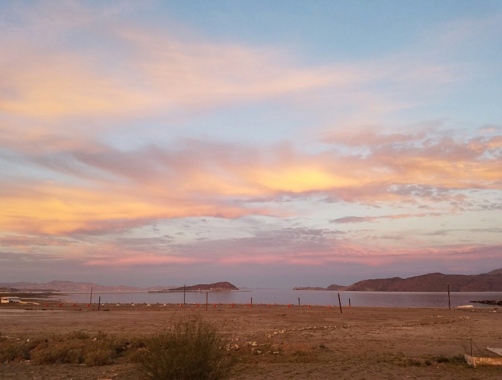
The Baja Peninsula threw everything she had at us and we still escaped serious injury and had no significant mechanical issues. We persevered through it all: slept in the snow, got stuck in the sand, blown over by the strong and gusty winds, poked and scratched by just about every plant with thorns, swarmed by thousands of bugs, embraced by the wonderful Baja culture, and even slept with a scorpion.

Here are a few numbers for you to ponder and for your entertainment:

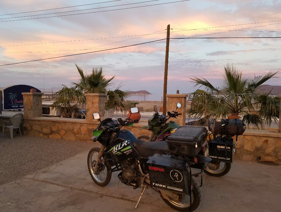
  • 5280 - miles driven on the motorcycles in two months
  • 29 - times the motorcycles were “dumped” or we crashed at low speeds (20 by Todd and only 9 by JT). Two of JT’s crashes were Todd’s fault! And Todd dumped his bike three times while standing still!
  • 7 - cameras used on the expedition
  • 36 - hours of footage from all the cameras
  • 8 - inches, the length of the “World Record” Nelson Trout caught by Eric
  • 530 - pounds in weight of each bike including gear, food, and water
  • 4 - people we met along the expedition that said, “You're the Devil’s Road guys! We've heard of you!”
  • 11,000 - feet, the altitude that Scott flew his plane, without a side door and with JT harnessed in so that JT can get aerial footage of the Sierra San Pedro Martir range of mountains

We look forward to sharing with all of you our stories and experiences. JT has an enormous task ahead of him to sort through and edit all that we have. When we have a working version of the film we will call upon all of you to help critique and finalize the film.

Again I would like to thank all of our sponsors, donors, and crowdfunding backers. We would not have been able to do this expedition without your support and generous contributions--in the form of mission-critical equipment and otherwise. I would also like to thank our assistant expedition contributors; Wayne Bruce, Scott and Laurie Bruce, Eric Bruce, Heidi Lewin, Bri Bruce, Jade Lewin, Gia and Eric Doughty, and Guy VanCleave. Because of all of you, we were able to secure some fantastic footage that will make this film shine.

As always, keep watching our website for updates and new items. And don’t forget to keep sharing the project with others on social media. We are very excited and pleased with what we have thus far.

Thanks again,

Todd Bruce
Producer, The Devil’s Road


"The Devil's Road" Main Expedition, Days 58, 59 & 60 (Return Home)

Return Home

It took us two and a half days to get from the border to our home in Santa Cruz. A stop in Ojai at my dad's house for the night was the perfect halfway point. We battled more gusty, strong, and always changing winds the entire way home. Our last day in the saddle was a total of 315 miles and that brought an end to an amazing two-month filming expedition through the heart of the Baja Peninsula.

"The Devil's Road" Main Expedition, Day 57

April 24 (Tijuana to San Diego)

I was filled with an honest mix of emotions when I woke this morning. JT was still sleeping and I slipped out of the hotel room to get a cup of coffee and reflect on my participation these last two months and in this project. On one hand, I was eager to get home and get back into my regular routine and be with Heidi. Yet, the other hand was wanting to hold onto more exploration, more time with JT, and more of what Baja encompasses. I have a love affair with this place that I cannot put into words. I have become accustomed to those around me speaking Spanish and me not knowing what they are saying. I have grown more comfortable sleeping on the ground in my sleeping bag and cooking over a fire of cactus wood, and I have secretly wished to keep going and seeking new Baja experiences.

One last shooting goal in Tijuana was all that was left. As we drove through the outskirts and downtown Tijuana, JT kept pulling over and running off to get a shot of this or that. His eye is keen with what he needs or what just happens to jump out at him. Several hours later, we were heading for the long lines at the border.

As it is always the case, we got in the wrong line. All other lines were moving faster than ours and we kept joking about jumping into another line and then having it be the slowest. As it turns out, motorcycles don't have to stay in line. They are allowed to split lanes and wedge in front of any car just before the border agent. So, we followed another motorcycles and skipped about two dozen cars and dove into a line with a slow and apparently very thorough agent.

Satisfied with our filming, the expedition, and how we met our goals, we set off to DMC Performance to fix JT's bike. It required a new chain and new rear sprocket to get her ready for the return trip home. We spent the night in Ramona at the home of JT's college friend Adam and his girlfriend Melisa's house. We were glad to be back in the States and very much enjoyed the company of old friends.

"The Devil's Road" Main Expedition, Day 56

April 23 (To Ensenada)

Wind! It seems that nearly the entire trip north we have been met with a headwind, wind from the side, and then gusty winds that tend to push our bikes around. We rode 136 miles today and landed at a hotel in Ensenada. JT's bike has been experiencing some issues with the chain and rear sprocket. The chain keeps loosening and would skip as he accelerated. We have had to tighten the chain several times, but can't figure out why it loosens after a day's drive. We will try to get it to a repair shop in San Diego tomorrow.

Bike problems outside Catavina

Bike problems outside Catavina

"The Devil's Road" Main Expedition, Day 54

April 21 (El Rosario to Sierra San Pedro Martir)

As we wind down our shooting schedule and travel northward, we have realized that there is not a whole lot of excitement, change, or new material for the film. We have been on this road before and our vision now is to have another opportunity to film the condors in the Sierra San Pedro Martir. With so few animals in the wild and such a vast mountain range, we would be lucky to get footage of the largest flying bird in North America.

We arrived at the "lower lookout" point at about 2:30 in the afternoon. The pullout was empty and we sat perched on the outcropping of rocks for over an hour and all we saw were turkey vultures and ravens. It was hot and the breeze blowing up the canyon was even hotter. We were able to find many footprints of condors in the dirt around the garbage can in the pullout. Apparently they tend to congregate there because of the garbage. With our heads hung low we headed up the mountain to the park and our camp for the night.

At the park entrance we were able to meet and talk in more detail with Manuel (Park Ranger) and Felipe (Biologist and Park Ranger) about the condor program and how best to film them. Our plan was set and we felt we had a good chance to film the condor in the wild the following day.

"The Devil's Road" Main Expedition, Day 53

April 20th ( to El Rosario)

It was a short drive to El Rosario where we ate a fantastic late breakfast at Mama Espinoza's. We secured a room for the night and went to work with the usual hotel chores (laundry, showers, charging electronics, and jumping onto the Internet, if available, to send data).

Punta Baja is a short 16-mile drive from town so we thought we would head out there and see what we could find. On the way, I stopped abruptly to watch a meter-long gopher snake cross the road. JT didn't see me in time and crashed. Thankfully, there was no damage to the bikes or to JT. He just tumbled over the handlebars and onto the soft dirt of the roadway.

While we were righting his bike, we were also attempting to wave the traffic away from the snake in the road. All said and done, JT did get some footage of the snake, but not until after it was run over once, then twice. In total, four cars ran over the snake and no one really seemed to care.

"The Devil's Road" Main Expedition, Day 52

April 19th (Guerrero Negro to a desert camp)

I had heard, some time ago, about an attempt to breed and set free the Baja Pronghorn Antelope. These majestic animals once roamed the peninsula in great numbers. By 1905, Nelson and Goldman were only able to find a few hoof prints, but no animals. We arrived at the facility unannounced and asked to film the animals. We were met with opposition, and insistence that protocols and permits were necessary and we were not allowed to film the animals. Disappointed, we took a few still photos and drove back out to the highway.

We were about 40 km from Punta Prieta when we passed a driver in a car heading south that frantically waved his arm and flashed his lights at us. We slowed as we rounded the curve and came face to face with a pickup truck in the ditch next to the road. Several passersby were helping the driver of the truck. His name was Neville and it appeared he had suffered a shoulder injury. I went into fireman mode while JT did his best to film the scene.

The police showed up shortly and went about trying to get all the information they needed for their reports and told me the ambulance was coming from Guerrero Negro and may take an hour. JT and I did our best to help Neville with gathering his stuff, making a list of valuable items, and securing his personal affects. He was very lucky that he was driving a newer Ford truck with airbags and was wearing his seatbelt. He said he swerved to avoid a pothole in the road!

With daylight slipping by, we found the perfect camp and quickly set about to stage our next shoot. Nelson documented how they would set up or take down their camp at night by setting fire to several dead yucca or agave plants. This would give them up to an hour worth of light. We recreated that very same situation with several dead agave plants. JT was pleased with the outcome. I, of course, was pleased to light something on fire!

"The Devil's Road" Main Expedition, Day 37

April 6th (La Paz)

Today we intended to drive out to a resort community on a spit of land in the La Paz Bay called El Mogote. This place is shrouded in controversy. On the peninsula is a 1,700-acre resort called Paraiso del Mar. It was planned to have 2 golf courses, over 3,000 homes and condominiums, a marina, a town plaza, and other amenities. The developer did not receive the proper clearances and approvals from the government prior to beginning construction, and abandoned the project in order to flee criminal prosecution. So, this "resort" sits with partial occupation and no means of access, except via water taxi. The "road" is notoriously sandy with a depth and texture that will swallow most 4x4 vehicles.

Our attempt to get there was denied about a mile into the section along the dunes. The sand kept getting deeper and the sand patches got longer. I dumped my bike once, which gave JT the chance to film how to right these heavy beasts. Then it was JT's turn. He attempted to turn around and found his bike chain deep in sand with no way to get out. We took this opportunity to film the procedure of getting unstuck. It all went well and we were both pleased to turn a bad situation into a good one. The swim in the bay helped, too, since we were sweating in the heat of the Baja sun after that ordeal.

The El Mogote has another story that needs to be mentioned. There are a number of shark fishing operations and is also a sea turtle nesting site. The turtles come to this peninsula to lay their eggs and the locals have instituted a "Protect and Release" policy. Forty-five days after the eggs have been laid, the babies hatch and the locals help get them to the water.

We met a wonderfully interesting man tonight named David from Alaska. He is riding a bicycle along the Baja Divide trail (the length of the peninsula). We had a beer and several tacos together as we swapped stories. We had seen him several times in multiple places along our route and were glad to get his story and comments on film.

The Birth of "The Devil's Road" and Searching for Goldman Peak (From the Producer)

Growing up in a family of strong women that continually kept the family history and stories of the past alive, I was truly stunned to find out just several years ago that “Uncle Ed” was a naturalist. Not only was he a naturalist, but he was a relatively well-known naturalist that worked for the United States Biological Survey and the Smithsonian Institution. My mother and grandmother often referred to Uncle Ed in a general, “what a great guy” kind of way. Just a year before his passing in 1945, he accompanied my mother (then only 11 years old), my great aunt, and my great grandfather (Edward’s brother) on a horse pack trip into the High Sierra Mountains.

Edward "Uncle Ed" Goldman, 1945 on horse pack trip in the Sierra Nevada. On this particular trip, the Broken Wagon Films producer's mother was present, accompanying Goldman, her uncle.

Not more than three or four years ago I learned the true background of Uncle Ed, known to the rest of the world as Edward Alphonso Goldman. I began an all out assault on the Internet to find out as much as I could about my great granduncle and his colleague Edward William Nelson. Among the more notable contributions they made to the natural history of Lower California and the documentation of many of Baja’s unknown flora and fauna, was a landmark expedition, the first of it’s kind, spanning one year and over two thousand miles on horseback. The work that the two naturalists did in Mexico has been described as “among the most important ever achieved by two workers for any single country.” Then through the Smithsonian Institution Archives I discovered a peak in Baja that was named after Goldman. Further research found that multiple sources concurred.

In the summer of 2014, I had the opportunity to travel to Baja with my oldest brother, Scott, and our sons. The four of us spent two weeks boating, camping, fishing, and drinking beer on the shores of the Sea of Cortez between Bahia de los Angeles and Mulege. It was on this trip that the idea to retrace naturalist Edward Nelson and Edward “Uncle Ed” Goldman’s route on motorcycles surfaced. It was then, beside a crackling campfire at the base of sand dunes in Mulege and beneath a sky filled with brilliant stars that we decided to embark on an expedition of our own. Paramount on our list of goals to accomplish during this expedition? Find Goldman Peak and climb it.

1919 map of Baja. Goldman Peak at center, northeast of Santa Gertrudis.

Finding the exact location of Goldman Peak began to gnaw at me, the desire growing stronger and stronger. I spent many hours in the library at the University of California at Santa Cruz pouring through historical texts. I came across a book written by Edward William Nelson titled The Natural Resources of Lower California. Nelson found during their expedition that many geographical features were without designations and thought it advisable to propose names for some of them. Many of the names he proposed were after early Baja explorers and missionaries.

Information about Goldman Peak’s exact location appeared to be non-existent. Nelson, who named the peak after his colleague and friend, Uncle Ed, placed the peak on his map at 5,000 feet of elevation on the 28th parallel of latitude, with the Santa Gertrudis Mission just south of the 28th parallel. Nelson wrote in Lower California and its Natural Resources that the map he created and printed in the book “…contains numerous inaccuracies of detail, but it is hoped that it would serve a useful purpose until more careful surveys are made.”

Another source stated briefly that the peak was northeast of the mission ruins and near the 28th parallel of latitude. Furthermore, Peter Masten Dunne wrote the following in Black Robes in Lower California in 1952: “The Giantees, crowned by the three lofty peaks, Las Virgines, thrusts her spurs down to the California sea and terminates in the north at an elevation of 5,000 feet at Goldman Peak” (page 1).

My next move was to turn my attention to today’s maps to see if I could find the peak. I spent hours and hours meticulously studying the dozens of different maps I could get my hands on—road atlases, topographic road maps, pure topographic maps, and satellite maps. I scrutinized them all. A thorough Internet search also did not reveal an exact location of the peak.

A half-day’s research at the United States Geological Survey in Menlo Park, California, turned up some very promising current maps and historical maps. Some had a great deal of detail, while others were shy of useful information. I did find, however, that all of the current maps used Spanish names for the mountain tops, peaks, and mesas in the area surrounding Mission Santa Gertrudis and the 28th parallel of latitude. I also found that Nelson’s map was incorrect, as he placed Mission Santa Gertrudis below the 28th parallel. Its correct location is north of this latitude line.

Names of prominent features in Baja seem to have a unique history. The Baja Peninsula itself has had several names imposed upon it over the years. Francis Drake, the famous English explorer and pirate, landed on the west coast of North America in 1579 and claimed it “sea to sea” for England and called it “New Albion.”  “Albion,” which means white, was an old term used to refer to England and her “white cliffs of Dover.” Later, a German Jesuit named Father Scherer and his geographer used the name “Carolina Island” to refer to the peninsula, mistaking it for an island. More recently still, the peninsula was just called “California,” then it was referenced as “Lower California” to differentiate between the southern region and “Alta California” to the north. Now the name Baja, which means “below” in Spanish, is the accepted name for the peninsula.

It wasn’t until I stopped looking for a peak named “Goldman Peak” on maps and attempted to look for Spanish named peaks in the general area roughly northeast of Santa Getrudis Mission that I found what I was looking for. On a map on page 12 of the 2009 edition of the Baja California Almanac, I found a peak at roughly the right elevation just west of the Santa Barbara Ranch and northeast of the mission. The name of the peak is Cerro Cantera Rosa. I believe this to be Goldman Peak.

It is my estimation that the name Goldman Peak has fallen out of use for one of two reasons. First, it was Nelson, a “gringo” that bestowed the name to an “un-named” mountain. The name “Goldman” is also a “gringo” name and may not have been accepted by the people of the region. Nelson took the liberty to name many features during the expedition; he named peaks after Kino, Salvatierra, Junipero Serra, Ugartes, Anthony, Bryant, and Brewster. He also named the Vizcaino Dessert and the Magdelena Plain. Only names with an early explorer’s name or historical meaning seem to have been accepted, i.e. Ugartes, Vizcaino, and Magdelena.

The second reason is that the use of “local” names was in favor. I strongly feel that the local peoples would use a particular name and it would have been passed down from generation to generation. Eventually, that named feature is placed on a map. Cartographers typically use preceding maps when updating or creating new maps. Another abnormality found is multiple names for the same feature. Often different names will be used on different maps. I found this map (http://www.bajaflora.org/GMap/Baja1930.htm), published in 1930, that placed “Sharp Peak” (with an elevation of 5,000 feet) near the location where Goldman Peak is believed to be located, thus continuing the confusion.

Regardless of the details, or lack thereof, we plan to climb Cerro Cantera Rosa, if for no other reason than to claim it as our own Goldman Peak.
 

- Todd Bruce, Producer, Broken Wagon Films, "The Devil's Road"

"The Devil's Road" Main Expedition, Day 15

Middle of nowhere to Bahia de los Angeles

During our debriefing last night we realized that we were one day ahead of schedule. Not wanting to camp at Yubay for two nights, we decided to head to Bahia de los Angeles, get a hotel, shower (since we have not had one in five days), charge all of our gear and batteries, and regroup.

Tomorrow we will head out to Yubay and meet Greg and Guy to film the tinaja and surrounding areas. 

Sunset over Bahia de los Angeles.

Sunset over Bahia de los Angeles.