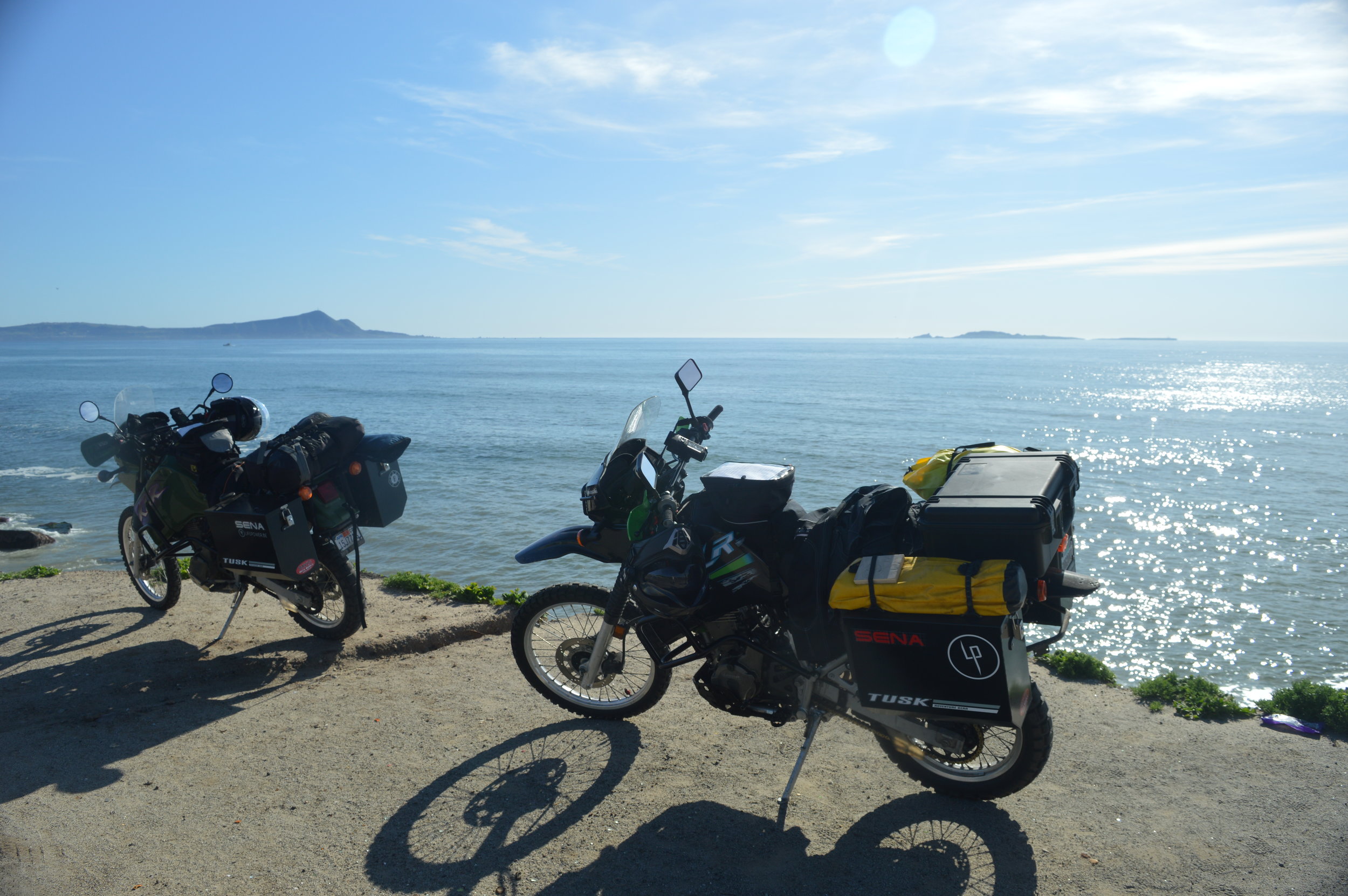
Viewing entries tagged
tourism

"The Devil's Road" Main Expedition, Day 37

April 6th (La Paz)

Today we intended to drive out to a resort community on a spit of land in the La Paz Bay called El Mogote. This place is shrouded in controversy. On the peninsula is a 1,700-acre resort called Paraiso del Mar. It was planned to have 2 golf courses, over 3,000 homes and condominiums, a marina, a town plaza, and other amenities. The developer did not receive the proper clearances and approvals from the government prior to beginning construction, and abandoned the project in order to flee criminal prosecution. So, this "resort" sits with partial occupation and no means of access, except via water taxi. The "road" is notoriously sandy with a depth and texture that will swallow most 4x4 vehicles.

Our attempt to get there was denied about a mile into the section along the dunes. The sand kept getting deeper and the sand patches got longer. I dumped my bike once, which gave JT the chance to film how to right these heavy beasts. Then it was JT's turn. He attempted to turn around and found his bike chain deep in sand with no way to get out. We took this opportunity to film the procedure of getting unstuck. It all went well and we were both pleased to turn a bad situation into a good one. The swim in the bay helped, too, since we were sweating in the heat of the Baja sun after that ordeal.

The El Mogote has another story that needs to be mentioned. There are a number of shark fishing operations and is also a sea turtle nesting site. The turtles come to this peninsula to lay their eggs and the locals have instituted a "Protect and Release" policy. Forty-five days after the eggs have been laid, the babies hatch and the locals help get them to the water.

We met a wonderfully interesting man tonight named David from Alaska. He is riding a bicycle along the Baja Divide trail (the length of the peninsula). We had a beer and several tacos together as we swapped stories. We had seen him several times in multiple places along our route and were glad to get his story and comments on film.

"The Devil's Road" Main Expedition, Day 46

Guest blog by Associate Producer Bri Bruce

Woke to a thick haze in the air, a mixture of fog and smoke—likely burning trash.

JT, Papa and I headed to Cerritos early, where I rented a board from a guy named Juan at one of the stands we had seen the day before. The surf was decent, though somewhat disorganized, more or less an extended beach break that sweeps around a rocky point below a large hotel on the cliff. There were only a few others out, and I enjoyed a handful of fast waves with short rides. 

I did a short interview with JT afterwards, then interviewed Juan who told us all about the changes he’d seen at this beach in the last ten years. The beach used to be relatively unknown, and was unbuilt, “undiscovered.” But now, more than a few large hotels dot the stretch of beach, and people come from all over the world to surf and swim. Juan explained how sad it was, but ultimately it was good for business. He and his brother owned the stand, provided rentals and lessons to beachgoers, and slept right there in the sand most nights.

We spent a few hours in the evening in the central part of Cabo San Lucas, walking the stretch of beach in front of the resorts that gave us a good view of Land’s End, the boats leaving and entering the harbor, and all the people.

We found an out-of-the-way place for some tacos and beer, then roamed around the main streets to film some of the nightlife. Loud music poured from the open entryways of bars and nightclubs. Men stood on the sidewalk handing out flyers, attempting to usher us into their establishments. There were families, and sunburnt couples, gaggles of women in high heels, groups of men yelling and jostling one another. Every so often we’d pass a bachelorette party, colorful tiaras or boas setting them apart.

Once we had our fill of Cabo, we made our way back to Todos Santos. We were silent on the drive home, most of us likely reflecting on the day, and the week, knowing some of us would be leaving in the morning.


"The Devil's Road" Main Expedition, Day 45

Guest blog by Associate Producer Bri Bruce

Awake before the others, Papa and I decided to go for a drive to see the area. We headed north toward La Pastora, through a sparsely built area, then drove out to a beach where several cars (including a school bus that had been converted to an RV) were parked in the sand. There were several surfers in the water beyond the rocky beach and we stood watching them for a while, noting they were wearing wetsuits in the much cooler water. We returned south, heading for Pescadero, and wound through the hills and dirt roads there, stopping at another beach, this time deserted. ATV tracks scarred the beach, not a person in sight. The beach was not conducive to swimming—or surfing—as the step beach caused the waves to double over and break right on the shore.

Continuing south again, we came to Cerritos, taking a dirt road from Mex19 to the ocean. Between the two large hotels on the stretch of beach, we found a smaller road that dead-ended into a series of tents and umbrellas. There were vendors selling hats and jewelry, tourists lounging about in beach chairs. Several stands of surfboards were propped up, with signs reading “Rentals” and “Lessons.” After doing a quick scan of the boards, and talking to a few of the people offering rentals, I found a stand to come back to tomorrow.

After a late breakfast back at the complex, JT and Papa left to film on the bikes, so Heidi, Jade, and I walked around Todos Santos’s historic district to visit a few museums and galleries. We stopped for some fresh fruit with chili and lime at the mission before heading back to plan the rest of the trip’s filming. 

"The Devil's Road" Main Expedition, Day 44

Guest blog by Associate Producer Bri Bruce

I woke at first light, made coffee, and walked to the bluff to find perfect dark lines of swell waves wrapping around the rocky point to the south. A gentle breeze dimpled the surface and I watched the steady strokes of a paddle boarder as they caught a few waves and rode them clear to shore. At the excitement of the conditions, I walked back to the condo to wake JT so he could film.

It was a perfect "Baja morning" by the time I paddled out. It wasn't long before the wind died completely, giving way to the stifling desert heat, the sky yellowing with day, the water becoming a clear blue-green beneath me. As I paddled for the point, I paused to look at the reef beneath me. My shadow was visible; I watched silvery fish glinting as their scales caught the light. Ahead of me, a fin or two broke the glassy surface, and even farther out the misty spout of a whale shot up from the horizon. 

I exchanged pleasantries with the paddle boarder, a woman named Tammy who worked as a social worker in Idaho and was currently on sabbatical. She had been coming to the cape for fifteen years with her husband, retired. She motioned toward JT on the shore, filming, and I told her about our project, and before long we were exchanging stories about how much change we've both seen in recent years. I made a remark about how little birds there were in the area, and how everything seemed almost hushed, lacking, as this was something I noticed the day before. She continued, saying the beaches here used to be covered in seabirds, all feasting off of sardines in the wide cove north of the point, but this was something she hadn't seen in years. She and her husband sold their fishing boat because there were just no fish left to catch. We shared sentiments on the current state of the peninsula, broken up by long pauses of contemplation as we waited for the next set to roll through. We took turns riding waves, conversing, and being in the moment. 

Eventually, she rode a wave into the shallow waters and continued paddling toward shore and exiting at the beach, done for the morning. Not long after, JT and Papa swam out to meet me, floating as I continued to surf. Still, questions gnawed at me in the wake of my conversation with Tammy, my observations about the lack of birds now amplified the more I paid attention to it. No birds meant no fish, and no fish.... well, what did that mean? Was anything being done about it? What impact does that have on the ecosystem as a whole? Where have all the birds gone, and more importantly, will they ever come back?


We continued south, then west around the cape. I had never been to Cabo San Lucas, and as we crested a small hill on the highway I caught my first glimpse of Land's End. I was shocked. Jet skis and boats of all sizes buzzed around the bay before the rocky point, leaving wakes like jet trails in every direction. Billowing, colorful parasails dotted the horizon, every bit of shoreline covered with sprawling monoliths of resorts and hotels. The opulence was disgusting, everywhere one looked--except on the other side of the highway where there was nothing but desert and dust leading up to the mountains--was sprawling with it. Such a manmade "paradise" at the expense of the natural beauty. I'd sen so many photographs of the granite cliffs falling into the sea, the iconic arch at the southernmost point of Baja, that somehow left out all of this. There was so much that wasn't supposed to be there. 

It was with slightly heavy hearts that we passed, mostly in silence, along the highway. 


Mex19 took us right to Todos Santos, the highway only slightly veering right and dropping us right into the central part of the town. We wound through narrow, brick-laden streets, past tourists taking photographs in front of the Hotel California (there is some speculation as to whether this is the Hotel California of the famous Eagles song). The old brick buildings in el centro, in the historical district, hold libraries and museums, art galleries and places for tourists to buy souvenirs and curios. Just beyond, the road dips down, through a palm forest, and the pavement ends. We're staying at a newly built complex behind a cafe and an ice cream shop.

Later we watched the sun set from the yard of the mission in town, a herd of goats wandering teh streets with bells around their necks. The clanging could be heard for blocks as they stopped periodically to munch on the plants lining the sidewalks, darting in and out of traffic.

We stopped by the Hotel California for a cold beer, didn't discover whether it was in fact the Hotel California (much to my disappointment) though learned that it had been in operation, originally as a tienda, since 1945 and then was renovated in 2002. For all intents and purposes, to me, it is the real Hotel California. We did eventually leave, and found a place a few streets away from the main road to have some tacos for dinner before heading back.

"The Devil's Road" Main Expedition, Day 42

Guest blog by Associate Producer Bri Bruce

Rose before the sun, an orange glow from the east across the gulf. The shorebreak echoed like thunder through the night, booming and reverberating against the stucco walls of the nearby houses. I took a short walk to the steps above the beach just as the sun was rising, creating a bright, eye-tearing glare off the water. There were already two surfers out at the rocky point, and I watched as they caught wave after wave, unencumbered. Their strokes were steady as they paddled back out to the lineup, then fluidly slid into the curling mouths of aqua waves rolling toward the shore. I was nearly giddy with excitement. 

Sunrise on the East Cape. 

Sunrise on the East Cape. 

Steer skull on the entryway.

Steer skull on the entryway.

On the walk back to the condo and while looking at the neighboring houses, I thought how strange it was (and what a feat of engineering, really) that these communities pop up all over Baja seemingly out of nowhere and in the middle of nowhere, so far from any central hub of a town or city. And most, if not all, have modern amenities--running water, electricity, cable, even wifi. On previous trips, calling home was unheard of. Checking email? Forget it. You were MIA for the duration of your stay. Completely disconnected. I prefer it that way. What happened to the simple life? Pura vida? Beachfront palapas, sleeping in the sand, catching fish or diving for rock scallops to feed yourself and your family, trucking in and storing water in 50-gallon drums, rise with the sun, sleep when its dark. . . . For such a long time this was, in my opinion, part of the allure of Baja: its harshness. You had to be okay with roughing it and going a few days or more without a shower, or devise creative ways to entertain yourself to pass the hottest part of the day. Sure, it was not an existence of convenience and undoubtedly many will disagree with my opinion. One travels to Baja to do just that: go to Baja. Immerse yourself in the sights, the culture. Why the need to bring home with you? Is it just a matter of comfort? How many resources are wasted for these kinds of conveniences? I can only imagine the waste associated with larger resorts and hotels along the cape. 

Baja is far from being Cabo; it is not Cancun. I hope it never will be, yet I can't help but fear it's evolution into a tourist destination is unstoppable.

Yes, the local economy benefits from tourism, but at the cost of Baja, its natural resources, flora and fauna. Large populations of tourists demand modern conveniences. This could mean a depletion of naturally occurring fresh water sources, or desalination plants for fresh water (at the cost of plant and animal life on land as well as already-sensitive marine life due to the resulting toxic brine), unsustainable (and perhaps unregulated) fishing practices, erosion, habitat destruction for fragile endemic species... the list goes on.

But is there a way to meld ecological preservation and tourism more seamlessly? Or does opulence breed opulence? Will one always outweigh the other?  

The World Conservation Union defines eco-tourism as "Environmentally responsible travel to natural areas, in order to enjoy and appreciate nature (and accompanying cultural features, both past and present) that promote conservation, have a low visitor impact and provide for beneficially active socio-economic involvement of local peoples."

One of our goals in making this film was to capture the beauty of Baja as it was at the turn of the last century, how it is now, and show what will happen if this region is forever at the mercy of those that want to exploit it. We are, at our core, eco-tourists, wanting to make as small an environmental impact as we can, enrich ourselves with Baja's culture, and appreciate it's beauty. We also want to share with the world all that defines Baja in hopes that our passion for it is contagious. To quote a number of conservation organizations, we protect the places we are most passionate about. Maybe we strike a chord in someone, or in a group of people. Maybe we bring to the surface all of the change over the last century, or of the importance of the work that Nelson and Goldman did for Baja's natural history. Maybe. We remain hopeful. 

"The Devil's Road" Main Expedition, Day 13

El Rosario to Cataviña

We were off quickly with a full day's filming schedule ahead of us. Our first stop was to take the 22-kilometer road out to El Marmol. This is an old abandoned onyx mine. It was being worked when Nelson and Goldman came through, but did not see it's hey day until the early to mid 1900s. The rock was said to be the finest in North America and was shipped to many parts all over the world. It is also the site of the only schoolhouse built of onyx. Now in ruins, it is clear to see the onyx walls and construction still standing tall. 

We attempted to take a side trip to Agua Dulce along the old El Camino Real. Now it is a private ranch, but in 1905 it was the only fresh water around for many miles. The "road" quickly turned into a sand pit and we made the decision to abort that attempt.

On the return to the main road, I dumped my bike at a slow speed on a small hill and it took both of us to right the heavy bike.  

While in the Sierra San Pedro Martir, we met Nathan, a young biologist and guide. He offered for us to stay at his cabin when we came to town. Arriving at his family's restaurant was a whirl of frenzied activity, as there were seven other people also invited to stay at his cabin. All of these folks were photography enthusiasts and two were Nathan’s friends we had met in the mountains.  

In a flurry, we left to his cabin "just twenty minutes away." Not knowing where we were going and just following the truck in front of us was not a good feeling for me. But, I trusted Nathan and the group was enthusiastic. It turned out to be twenty miles on the worst road I have ever been on. The sand was the worst. As the sun was setting, it was getting harder and harder to see the tracks in front of us. We finally made it, and I only dumped the bike 5 times compared to JT's one.  

Nathan's cabin sits on an 8,000-acre ranch and we were promised a tour that would be like no other in the morning. We all sat around a big fire, made burritos, and drank beer, tequila, and mescal. We crashed in the bunk beds in one of the many rooms of the cabin. 

Nathan, local Catavina resident.

Nathan, local Catavina resident.

"The Devil's Road" Main Expedition, Day 4

Ensanada to Laguna Hanson

There was every conceivable noise and sound last night. The hostel is in the middle of town and I swear there was a police station just down the road. I could hear sirens all night long. We woke and got all of our gear back onto the bikes, which took quite some time. We had to shove the bikes into a very narrow alley (so narrow the panniers had to come off in order to fit) that could be locked.

La Bufadora is a natural blowhole in the rocks at the point on the southern end of Todos Santos Bay. It is quite the tourist attraction, with bus loads of tourists coming and going throughout the day. Everyone has to walk down this path that was like running the peddler's gauntlet. One could buy just about anything imaginable from these barking, persistent enterprising folks. With that attraction checked off of our list, we needed to get out of town! Saturday midday in Ensenada is not the time one should be trying to cross town to get to Highway 3! We were slowed by a funeral procession, blocked by emergency vehicles, and nearly sideswiped by a VW bug. 

Producer Todd Bruce

Producer Todd Bruce

Things really calmed down once we were off the pavement and onto the dirt roads heading to Laguna Hanson for the night. Or so we thought... We had a crash course in driving these heavy bikes in just a thin layer of sand; our GPS coordinates were definitely off by .3 to .5 miles, and we had our first dumping of a bike. I was in front and trying to negotiate too many ruts and washouts when I had to slam on my brakes to keep from launching into a chasm. JT, in an attempt not to hit me, did a 5 mph pitch and into the sand he and the bike went. Luckily, the only damage sustained was the sheering off of one of the fuel bottles. JT's pride was bent, but he was glad to get it over with, as it was the first spill. We arrived to find a perfect camp out of the wind right next to a group of large boulders.

Laguna Hanson was full and there were several rafts of duck out on the water. The lake is named after a Norwegian that was the first white man to see this lake. He built a nice ranch just down the hill from the lake in the late 1800s. That ranch is now, and was in 1905, called Rancho El Rayo. When Nelson and Goldman came through here, the ranch was the only place during their trek where they were confronted with unfriendliness and a disagreeable attitude.  

"The Devil's Road" Expedition: Days 1, 2, & 3

MARCH 1st (DAY 1)

We woke to a beautiful and chilly day in Santa Cruz to start our two-month trek into Baja California. Bill Sylvester (a retired fireman and friend of ours and one of our adventure consultants) showed up to send us off. Our friend Eric Doughty and his 5-year-old daughter, Gia, accompanied us for the ride through California. All went smooth until we were swallowed up in the greater Los Angeles traffic and the trailer started to wildly fishtail. A slower speed, faster speed, or use of another lane did not help. It was on the second safety stop when we found
that the nut holding the ball onto the hitch has loosened and we were millimeters away from catastrophe. Tragedy adverted!

We arrived at the Potrero County Park (San Diego County) at about 9:30 pm and went about setting up camp, starting a fire, and cracking open a bottle of whiskey. Even though it was very windy and a little chilly through the night, we slept great.

Camp at Potrero County Park (San Diego County)

Camp at Potrero County Park (San Diego County)

Campsite at night or arrival. 

Campsite at night or arrival. 


MARCH 2nd (DAY 2)

A sunny and warm day greeted us and allowed the needed time to pack. We spent the morning organizing, packing, and finalizing any last minute storage issues and drove the bikes to the town of Campo for fuel and a treat for Gia. We are surprisingly calm and excited for the journey ahead. Baja is a magical place for us and we both always feel at home when we are there. Can't wait.


MARCH 3rd (DAY 3)

The wind was blowing hard this morning when we woke up. The area looked like a garage sale, our stuff strewn about from the wind. A whole roll of paper towels was flapping in the wind as one end wrapped around a tree. After a quick breakfast and several cups of mocha, we packed the bikes were sadly saying goodby to Eric and Gia.

We didn't make it but a mile down the road when we had our first blunder. My Sena camera fell off my bike, hit my foot, and slammed onto the pavement while accelerating to 30 mph. The case blew apart, camera parts flying everywhere as JT and I madly tried to keep the other cars from running over the parts. We think we got all of them!

Today was as much about working out problems as it was about getting the filming started. JT forgot to put the locks on the top box as he drove off and nearly lost them. I just about dumped my bike twice while standing still! Our phones are not working. The GPS coordinates appear to be about a mile and a half off. It was all trial and error while figuring out how to use our Sena 10c cameras.  

We had a great ride along the Ruta de Vina. A beautiful road that winds through Baja's wine country and the Guadalupe Valley. This route was the road that Goldman took in 1906 at the end of their expedition. The pair took a steamer from La Paz to Ensenada once the expedition was complete. Nelson continued on to San Diego via steamer and Goldman took a stage coach from Ensenada to Tiajuana through the Guadalupe Valley.

Valle de Guadalupe, Baja's wine country.

Valle de Guadalupe, Baja's wine country.

Ensenada is a huge city. In 1905, there was only about 1,000 people living here and life centered around the waterfront. Now, the city thrives on the shipping industry, tourism abounds with the cruise ship bringing thousands of visitors daily, and one could find just about anything you desire here in this bustling and sprawling community.